Monday, January 30, 2012

Big Majors Spot

We took a break yesterday, after taking our dinghy through the mangroves to the Sound, then we rode over Elbow Cay. It is rugged and foreboding, even before we found a wreck on the NW shore. We think we found an old wooden boat mast and the timber hull ribs. There was no information about in the guidebook, so we are left to our own imagination. I shudder at the thought of encountering that iron shore.

Today we weighed anchor just after 7 am, intending to arrive at Big Majors before the winds increased and headed us. It was all working according to plan for the first two hours with the winds NE on our quarter stern, then the squalls lined up and made the very weather we were looking to avoid. It was a hard beat into 20-25 knots the last couple of hours. We were not the only sailors with high hopes, there were 10 other sailboats right with us. Now we are at anchor, the squalls are gone (for now) and the weather is acting according to forecast at 15 to 20 knots out of 050 (NE). This is a great anchorage and well known. There must be at least 40 other boats here of all sizes and types.

We hope to snorkel the grotto tomorrow and see the swimming pigs. We can see pigs on the beach from here, but we were too beat to put the dinghy together and ride in. It sounds like a good stop on our way out to the grotto.

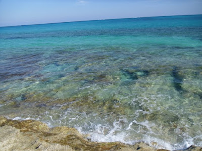
I forgot to mention a phenomenon I have observed for the first time in the Bahamas: Clouds with blue/green reflection on the bottom. Myron remembered that our friend Chris mentioned seeing them in the Pacific, he said that was how you could tell the location of an island. The clouds reflect the azure water. I do not believe I will ever grow tired of the beautiful hues of blue/green and the contrasting white sand.

It is time to get the bread in the oven.

Love to all,
Dena

Posted via Ham radio.
{GMST}24|11.047|N|076|27.803|W|Anchored|Big Majors{GEND}

Sunday, January 29, 2012

Shroud Cay

We are anchored off Shroud Cay and took a dinky ride up the mangroves to the Exuma Sound side, what a blast.
A cold front will pass tonight providing winds to sail south to Big Majors and the swimming pigs more on that later.
Peace to all
Myron

Posted via Ham radio.
{GMST}24|31.344|N|076|47.664|W|Anchored|Shroud Cay{GEND}

Saturday, January 28, 2012

Norman's Cay

We stayed in Allen's Cay waiting for good weather to go out into the sound and do some fishing. It was a nice stay. We met more new people, snorkeled a number of different reefs and visited the iguanas on the beach everyday.

Today, though, was all about fishing. We heard over the radio that some folks were getting strikes north of Highborn Cay. The winds calmed down through the night which made the Exuma Sound lay down nicely. In the morning it was calm seas, a gentle breeze out of the ESE, and bright sunshine: perfect for fishing. It was so calm, and coming up on high tide, that we took the Allen's Cay Cut, we would not take it under any other conditions. As we hit deeper water and rounded the north point of Highborn Cay we got a double hook-up. Unfortunately, while landing the first fish the second fish worked its way off the hook. When I went to gaff the mahi, there were several swimming around down below. I have never seen so many mahi in one place. Our hands were full navigating and butchering and storing fish. Myron was still studying how to butcher out the fish collar when we got another hook up. This second fish was a good fight. It seemed to take forever bring in, and then it would run out again. Myron gave me a couple of turns at reeling it in (and having it pull the line back out). After at least 10 minutes the fish finally surfaced and then we knew what we caught. It was one of the largest mahi we have ever landed - probably four feet. I know people catch larger, but it was a record for us. Now our fish lockers are full and we are ready to head into the Exuma Park area, where fishing is prohibited. We have enough to share if we choose, and we gave a few good pieces away today to Fred, a fellow single-handing on a Nordic Tug, 'North Star.' He told us about some neat places to go, good tips, well worth some fillets!

After the fishing, we came in Norman's Cut and anchored off of Norman's Cay. This cay was formerly controlled by a drug lord (Carlos Lehder). He was depicted in the movie 'Blow.' There is a DC-3 airplane that crash landed in the water here some time back. We snorkeled that airplane shortly after putting our anchor down. We also walked Norman's Cay and saw the runway and the clubhouse. Then I blew out my tire tread sandals and we had to cruise on back home (does not quite work with Jimmy's song...)

It has been a big day. We just finished a fish dinner, cleaned up and watched a beautiful sunset. We can share pictures when we have internet. In the meantime, Myron will get this out over the ham radio and I may be asleep before he is finished.

Love to all,
Dena

Posted via Ham radio.
{GMST}24|35.359|N|076|48.793|W|Anchored|Norman's Cay{GEND}

Monday, January 23, 2012

Allen's Cay

Chris and Gretchen on 'Alchemy'(New Bern, NC), Michel and Sylvie on 'B to B' (Quebec, Canada), and Tom and Delwyn on 'Mahalo' (Vancouver, Canada). What could we all have in common? For each of us, it is our first time cruising our own boat down the Bahamas. We are all in this little anchorage, plus a couple of other boats we have not met yet. We all remarked on some difficulties we encountered to get this far, some more than others. We all hope it gets a little easier from here! It was fun getting out and meeting people today. It was also a treat to do some snorkeling with Tom and Delwyn, the only other folks in our previous anchorage for the last two nights. We found conch but did not have gloves. A return trip to that reef may be in store for tomorrow. I would still prefer some warmer water as I did not last very long on the snorkeling. The water temp is about 72 degrees. We used to snorkel at Catalina Island in colder waters, but I was younger then!

This anchorage is known for the iguanas on the beaches. We are not supposed to feed them (so we did not), but they came out to meet us on the beach and seem to be expecting a handout. They ran up to us. It is rather creepy. Once we stood among them for a while, they mostly seemed to just sun themselves and listen to us talk. Sometimes the largest males sparred for a bit, then stopped and took in sun again. I can appreciate the conservation of energy. It is now 8 pm and I am ready to turn in!

Love to all,
Dena

Posted via Ham radio.
{GMST}24|44.937|N|076|50.308|W|Anchored|Allen's Cay{GEND}

Saturday, January 21, 2012

Current Cut to Ship Channel Cay

We started our day listening to Chris Parker's weather. Our winds would be ESE at 14 or less and only one place in 100 might see a rain squall. This was good news for our passage across the shoals and through the coral head area.
We followed Mark on 'Down Island,' an Island Packet 40, through the Current Cut and on the tricky turn to the south. We thank God that we were blessed to have someone well familiar with the area lead us through. Mark then headed for Tarpum Bay and we headed for Ship Channel Cay on the Exuma Bank.
I had been practicing 'reading' the water for days. I still seem to be about two feet off on depth. After today, however, I know I can spot a coral head! They look like black ink has polluted the beautiful azure water. They are just as odd looking as they are scary. Myron secured a spot for me on the bow and I used a handheld to talk through turns or verify that he had a visual on the 'bomber.' We were working through the coral head area pretty well when the winds piped up and we got the one in one hundred rain shower. Looking for coral heads in the shadow of clouds or during rain can be quite stressful. I was still able to pick some out, just with less warning to Myron. There were times I would pray to God that I could not see the hazards and a little hole would open up in the clouds, and the sunshine would light up the coral head. I kid you not. Then we got our second rain shower. We were certainly beating the odds of Chris' weather forecast.
We motored with a full main through the hazards and dropped anchor at Ship Channel Cay after almost seven hours of highly attentive work from the both of us. We were worn out as if we had been sailing for days! We had a substantial lunch that tasted like nap. Now we are a little rested and considering what to explore tomorrow. Only one other sailboat is in the anchorage and they arrived just a short time ago. We never saw them on our leg so they must have come from Nassau.
After many crowded anchorages, this edge of the world contrast is remarkable. I wish we could get our track up, but the position spotter should give you an idea of the solitude. There is no civilization at this cay.
Love to all,
Dena

Posted via Ham radio.
{GMST}24|48.690|N|076|49.725|W|Ship Channel Cay{GEND}

Friday, January 20, 2012

Current Cut

Today we made no hard plans for a destination, but rather planned a fishing trip. After coffee and a few chores, we motored out of Royal Island Harbor then set the jib to run downwind back to Little Egg Island cut, the one we came in. We fought grass on the lures for at least 45 minutes then finally ran clear of the nasty stuff on the west side of the banks. We ran the deep water off the banks for at least an hour and never got a hit until we came in the Current Rock cut. That strike did not hold but sure put a dent in a very big lure (eight inch). We did not get the fish, but it left us its tooth!

We anchored off 'North Beach' of Current Settlement, put the dinghy in and shot through the Current Cut around to the public dock. We were in search of ice cream. Current Settlement's downtown consists of a post office, general store, church, public phone and a community center. They are mostly recovered from a devastating hurricane (Andrew). It is really beautiful here, with the contrasting blues from the water's depths and clean white sand. We are very happy we did not pass this by. The weather is calm enough for us to enjoy the evening.

We met Mark on 'Down Island,' who wrote a book by the same name. He has been here several times and offered to lead us through Current Cut and the jog to the west. We are taking him up on that offer. After that we go our separate ways, but expect to see him again in Georgetown.

Love to all,
Dena

Posted via Ham radio.
{GMST}25|24.720|N|076|47.416|W|Anchored|Current Cut{GEND}

Thursday, January 19, 2012

Royal Island

Except for the smoke from some significant fire on Great Abaco Island, we had a nice rest at Lynyard Cay. We pulled up anchor about 6:45 am and dropped the hook here about 4:30 pm, better time than we expected.

We ran the Little Harbour Cut just after sunrise. It was more favorable for the swell than the North Bar Channel. The winds were out of the west. We had a full main up and later pulled out the full jib. We were running about 3 points free from our closest reach. As forecast, the winds came behind us (NW) for more of a broad reach, so out came the new mizzen. We do find it interesting that the winds do not consistently clock around. They kind of hold their breath for a while, then come back at us from a new point on the compass. More than half way across the Northeast Providence Channel, the winds were nearly on our stern (from the N). We poled out the jib on the windward side and had full main and mizzen to leeward. While great for sailing, it was quite a handful when we thought we had a fish on. All fishing was a bust today, not for lack of trying. We kept catching sea grass. That can be a handful to pull in for cleaning when Hold Fast was clipping along at 8 knots. We had to reef down the jib and slow her down a bit to allow the new autopilot to keep up. As the day progressed, the seas grew, but it did not hamper our running the Little Egg Island Cut. The winds are now out of the NE and may go more east. We are well protected here at Royal Island, at least from the wind and swell. We just saw a 120+ foot landing craft come in and work through the boats anchored to the west (we are on the east side of the harbor). In case of that sort of traffic at night, Myron has installed a large cockpit light that pretty well marks us out.

Time to get some dinner and rest.
Love to all,
Dena

Posted via Ham Radio.
{GMST}25|30.932|N|076|50.618|W|Anchored|Royal Island{GEND}

Noon Postion Report

We are having a great passage jib main and mizzen all pulling us at 7.2 kts.

Posted via Ham Radio.
{GMST}25|50.830|N|076|56.380|W|Noon Position|Underway{GEND}

Wednesday, January 18, 2012

Lynyard Cay

I must say I enjoyed Hope Town. It might be a different place on a weekend, but we thought it was quite pleasant. It is very quaint although everything seems to be for sale or rent. We met some nice folks on a beautiful power boat, 'Ganesh.' While we waited for high tide, we had another walk around town and found the elementary school and their garden. They grow things such as tomatoes, herbs, lettuce and chives. It is there for the taking, but they do ask for donations. All the 'maters were gone on our visit, but I like the way they think.

We left Hope Town at high tide, not only to get out (it is a bit shoal for us) but also to take a short cut inside the Parrot Cays. There was about a five foot swell running after we came around Tilloo Bank and near the Pelican Cays. It made us reconsider possible anchorages and wonder how uncomfortable it might be in Lynyard Cay. The wind has since turned very light and from the west. Lynyard is turning out to be just fine. we need to rest up as the winds look favorable (west and then turning northeast) for our ocean passage tomorrow, the Northeast Providence Channel.

The Abacos were very nice, and made even more special since we were able to visit with precious friends.

Love to all,
Dena

Posted via wifi
{GMST}26|21.988|N|076|59.236|W|Anchored|Lynyard Cay{GEND}

Tuesday, January 17, 2012

Hope Town

Marsh Harbour was a nice place to wait out winds due to the good holding and availability of provisions. While there we heard over the radio that, with the right equipment, we could get some Florida network channels. We were successful in catching Saturday’s playoff games. In Jacksonville, it had become Myron’s habit to watch football games with Stuart on ‘Clementine.’ We both mentioned that it would be nice to be watching the games with Stuart again. On Sunday during the first game, I stepped out in the cockpit to check our position with the other boats when I heard a sweet child’s voice calling out my name. To our delight, we saw Clementine preparing to anchor nearby. We jumped in the dinghy to welcome them to Marsh Harbour and invite them over to watch the football game. Stuart and Myron enjoyed the first half of the GB/NY game while Kylie, Sami and I played a few board games. I could not think of a better way to wait out inclement weather.

On Monday, Kylie and I did chores in town and later took Sami out for an ice cream. We had a wonderful fish dinner on board Clementine that evening, tag-team cooked by Stuart and Kylie, preceded with a Catch Phrase game. Myron helping out Sami with Catch Phrase game:
From Marsh Harbour
On Tuesday, it was hard to separate from our friends, but they were headed for Man-O-War Cay to visit with friends and we were headed to Hope Town and then south, timing a weather window to exit the Abacos. We just assume we will see them again, somewhere.
We arrived at Hope Town inlet near high tide, as it is too shoal for us at low tide. It is always interesting coming in to an unfamiliar place, but add to that a shoal and tight inlet, as well as a tight harbor and I could say we were a bit on edge. We found a double green mooring that had a vessel name, however the boat next to us said it was available. We were thankful for that information because it would have been difficult in the strong winds to weave around the boats to get to the one and only other mooring available to us. We are thankful to get the second to last mooring, although our backup plan was to anchor outside. The lighthouse beckoned us to visit, one of the most photographed lighthouses around.
From Hope Town
From Hope Town

We will leave Hope Town near high tide today and stage to cross to Eleuthra. We do not expect to have internet for quite some time, so we will load pictures and movies while we can.

Below, please enjoy some video from the lighthouse:


Love to all,
Dena
Posted via wifi
{GMST}26|32.271|N|076|57.646|W|Mooring|Hope Town{GEND}

Monday, January 9, 2012

Marsh Harbour

We had a wonderful and quiet stay at Man-O-War Cay. A big thanks to Barb and Barry on BeachCruiser. They made us feel right at home. We felt secure on the moorings at East Harbor and that opinion was proven out when a strong cold front graced us with wind gusts out of the NW of up to 46 knots. During the cold front passage, we did fire up our coal stove at least twice. Other than that, our weather was placid and enjoyable. Sun setting beyond the MOW Cay entrance:
From Man-O-War Cay
MOW Cay is populated with golf carts, no regular vehicles that we observed, a fact that made our frequent walks to the “low spot” all the more pleasant. View from the "low place" (an area sometimes under water at high tide)
From Man-O-War Cay
From Man-O-War Cay
On a few occasions we treat ourselves to dining out, at MOW we splurged them all at Bradleys on the Harbour. We highly recommend that cuisine if you make it to MOW Cay, the chef is top notch. Another occasional indulgence is ice cream. I discovered coconut almond fudge at the ice cream store on MOW Cay, yummy! Our extended stay and the calm weather allowed us to attend church two Sundays. Pastor Randy is a go getter. Rich preached on New Year’s Day based upon the sermon “Are you Ready” from J.C. Ryle, a 19th century pastor and contemporary of Charles Spurgeon and D.L. Moody. Good stuff. Google it and read it if you are so inclined. We also appreciated Ralph Albury’s faithful teaching of Sunday School. We gave Ralph a book we had just finished: “War on Truth” by John MacArthur (contributed by Irene!), something we thought he would appreciate based upon his love for God’s Word. As always, it was hard to leave this nice community and safe harbor. We moved to the south of the cay, set anchor, made water for a while and then motored to Marsh Harbor still making water. We made close to 85 gallons by the time we arrived. The moon was bright and full at the latter part of our stay at MOW Cay, so bright it convinced a rooster that 4 am was the appropriate time for a wake-up call, a call that continued until first light at 6:30 am. The impact of those early mornings hit me yesterday after we set anchor in Marsh Harbour, had a filling lunch, and I suddenly succumbed to a surprise nap attack. After a deep rest, we set into town. We were familiar with town because Barb and Barry brought us over in their skiff last week and showed us around. We thank God that we were able to refill Myron’s subscriptions and restock on fresh veggies at Maxwell’s. We will likely remain here as we wait for another cold front to pass. While here, we hope to refill on diesel and gas, as well as accomplish a laundry day. We are only 1/2 tank down on propane, so that can wait. We experimented with posting a video for you. The video below is of our sail south from Mayport: Love to all, Dena Posted via wifi. {GMST}26|32.821|N|077|03.413|W|Anchored|Marsh Harbor{GEND}